In this guide
A tide table tells you about water level at a specified place and reference. A current prediction describes horizontal water movement. For fishing, both can be relevant, but they answer different questions. Use water level to investigate access and depth; use current information to understand likely flow. Neither product certifies a place as safe or tells you when fish will bite.
Separate three questions
| Question | Information to seek | What it does not establish |
|---|---|---|
| How high is the water expected to be? | Tide prediction for the appropriate station, date, units and datum. | The exact depth over every feature. |
| When and how strongly will water move? | Local tidal-current predictions and navigational advice. | A universal relationship to high water. |
| Can I reach and leave the fishing position? | Local access knowledge, observations and a conservative exit plan. | Safety from one tide number alone. |
Why high water is not always slack water
NOAA explains that the timing relationship between tide height and current varies by location. A common shortcut assumes current stops at high and low water. That shortcut fails in many places. Tide predictions and current predictions are therefore separate products. Do not transfer a slack-water time from a different entrance, channel or harbour merely because it is nearby.
NOAA also distinguishes tidal currents from wind-driven and density-driven circulation. For a fishing plan, this means a table based on the astronomical tide is only part of the picture. Keep the forecast and actual conditions alongside the prediction. If they disagree, investigate rather than treating the table as the stronger evidence.
Read a prediction carefully
- Confirm the place. Read the station name and its location, not just a favourite saved in an app.
- Confirm the date and displayed time convention. Check whether the service uses local time, daylight-saving time or another zone.
- Read the units. Keep metres and feet separate in your notes.
- Identify the vertical reference, or datum, used for the height. A tide height is not automatically the water depth at your fishing position.
- Check the product’s purpose and limits. A recreational beach display may explicitly prohibit use for navigation.
- Read the current marine forecast and any local warnings. Then assess the actual site before committing to it.
Make the exit decision on land
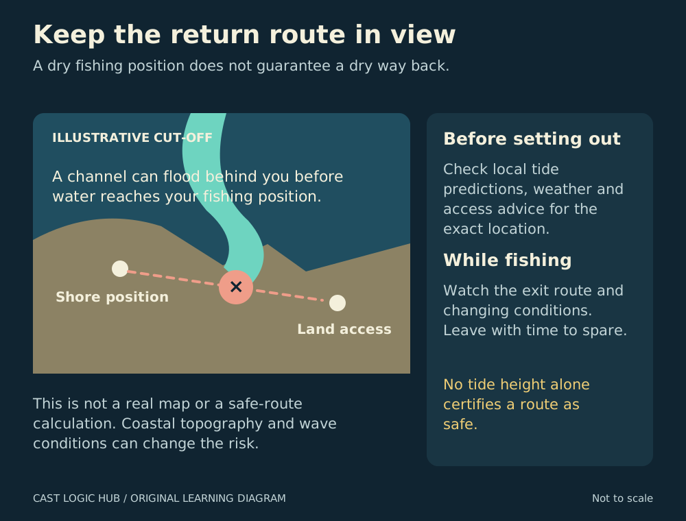
The RNLI highlights routes around outcrops and into coves that become cut off as water rises. Walking farther up the beach may not provide an escape. When the exit depends on a narrow ledge, causeway or low crossing, obtain reliable local advice and select a different place if the route cannot be understood confidently. Do not create your own crossing deadline by drawing a straight line between high and low water.
The Met Office notes that beach tide times may use a nearby port rather than the exact beach, and that its beach information is not for vessel navigation. Use that distinction in planning: a convenient forecast tile can prompt questions, but it cannot validate passage over a bar, access to an island or clearance under a bridge.
Use tide information to design a fishing test
Choose a clearly identified feature and record what actually happens as conditions change. For example, note whether a current lane becomes visible, whether the presentation tracks differently and whether the bank you need remains accessible. Compare repeat visits using the same source and station. Include unproductive visits so the record is not built only from memorable catches.
Write “three bites while the bait tracked along the outer edge” rather than “fish always feed two hours before high tide.” The first statement is a useful observation. The second claim would require evidence across many comparable sessions and still might not transfer to another season or species.
When to discard the plan
Reassess immediately if the sea covers the intended route earlier than expected, waves reach the working position, visibility falls or local advice contradicts your assumptions. Being on schedule does not make an unsafe position acceptable. Save the fishing experiment for a session in which your access and return are straightforward.
Questions from the bank
Keep it helpful. Comments are moderated. Do not share precise locations or personal information.
No approved comments yet. Ask a practical question or share what you learned.